Locations & Directions
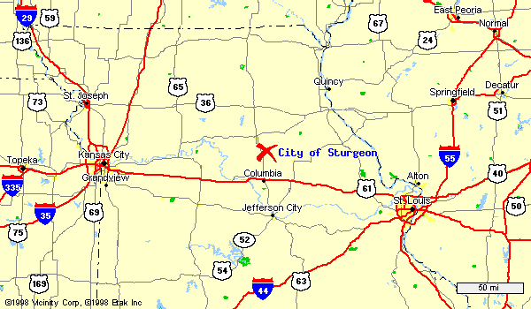
Easy to find, it's near US-63 and M-22 in Boone County's quiet northwest corner. Sturgeon is located close to major highways, yet separated by green fields that soak up the highway noise and fumes. All you have to do is turn off Highway US-63 or M-22 --- or turn onto one of the alternative roads (RT-CC from US-63 or Centralia, or RT-V from Hallsville) that lead you to Sturgeon.
No matter which entrance route you choose, you will quickly find yourself in the good life of small-town America and the inescapable fact that Sturgeon folks make good neighbors.
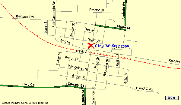
Sturgeon is a 4th Class City with a Mayor/Board of Aldermen form of Government. It's population is about 837 residents. Primarily an agricultural community situated on rolling prairie, the average annual rainfall is 36.9 inches and the average snowfall is 19.5 inches. It's elevation (0.2 miles west of the Ogden street rail crossing and 60 feet southwest of the road crossing) is 857.525 feet above sea level.
Sturgeon is located in northern Boone County, Burbon township, three miles east of US 63 and one mile south of State Highway 22. Route V and Route CC intersect in the town and are the principle accesses. Sturgeon is approximately 22 miles from Columbia, 23 miles from Mexico, 10 miles from Centralia, 20 miles from Moberly and 58 miles north of the Missouri State Capitol, Jefferson City. The Norfolk and Southern Railway runs thru the town.
Locations
City of Sturgeon
303 East Station Street
Sturgeon, MO 65284
City of Sturgeon City Hall